Kittitas County FEMA Mapping
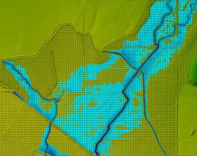
The Kittitas County Department of Public Works desired to better understand flood risk along ten streams that descend from Colockum and Ryegrass ridges north and east of the City of Ellensburg. They also desired updated FEMA Flood Insurance Rate Maps for two of the streams, Currier and Whiskey Creek. WSE was retained to develop a single HEC-RAS 2D hydraulic model that included all ten streams, an area covering approximately 100 square miles. Highly detailed individual HEC-RAS 2D models were also developed for both Currier Creek and Whiskey Creek to prepare new FEMA maps.
Role/Services: Hydrologic evaluations were completed to estimate the FEMA flood discharges. Hydraulic modeling was undertaken using HEC-RAS 2D to assess flood risk and accurately map the floodplain and delineate the floodway for each stream. WSE worked with FEMA and their regional mapping coordinator to develop methodologies for the 2D modeling and mapping, which is not covered by FEMA guidelines.
Outcome: The project is ongoing. The project budget is modest for this work, and WSE is working closely with County staff to ensure the budget is utilized efficiently and effectively.
